
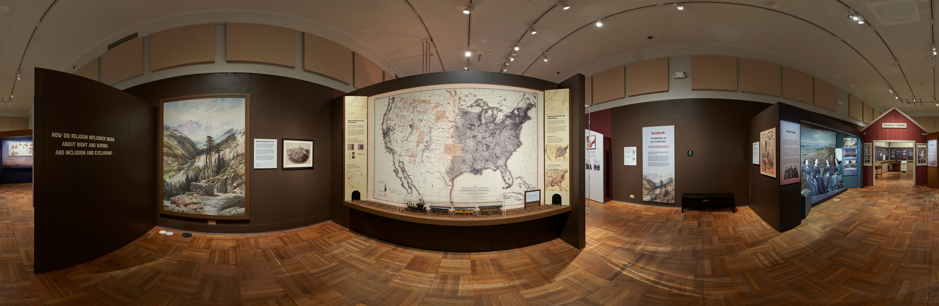

Representing the US in Numbers
The 1870 Census documented
the momentous changes ushered in by the Civil War. Maps, charts, and reports
conveyed information about the consolidation of the nation—including new states
and territories, a transcontinental railroad, and mining surveys.
Also embedded in the census
were hints of unease regarding race, religion, and claims to rule. This map
showed that while most Americans still lived east of the Mississippi, Native
peoples were increasingly confined to Indian reservations in the West. In the
next few decades, the US would pursue military, political, legal, and
educational measures to further control Native lands and lives.
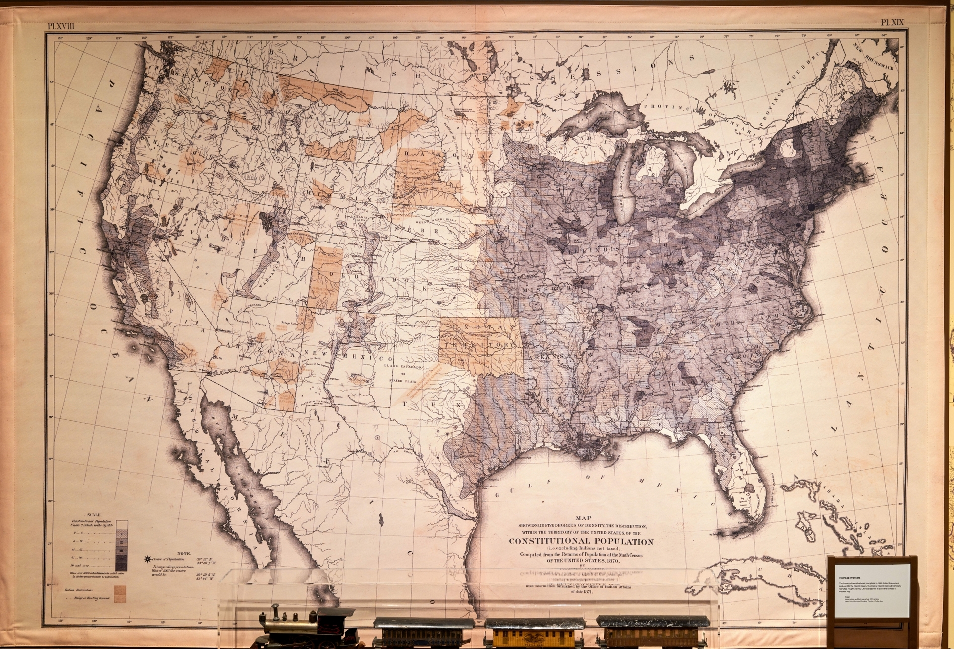
1870 US Census
Map showing in
five degrees of density the distribution within the territory
of the United
States of the constitutional population, i.e., excluding Indians not taxed
Library of Congress, Geography and Map Division
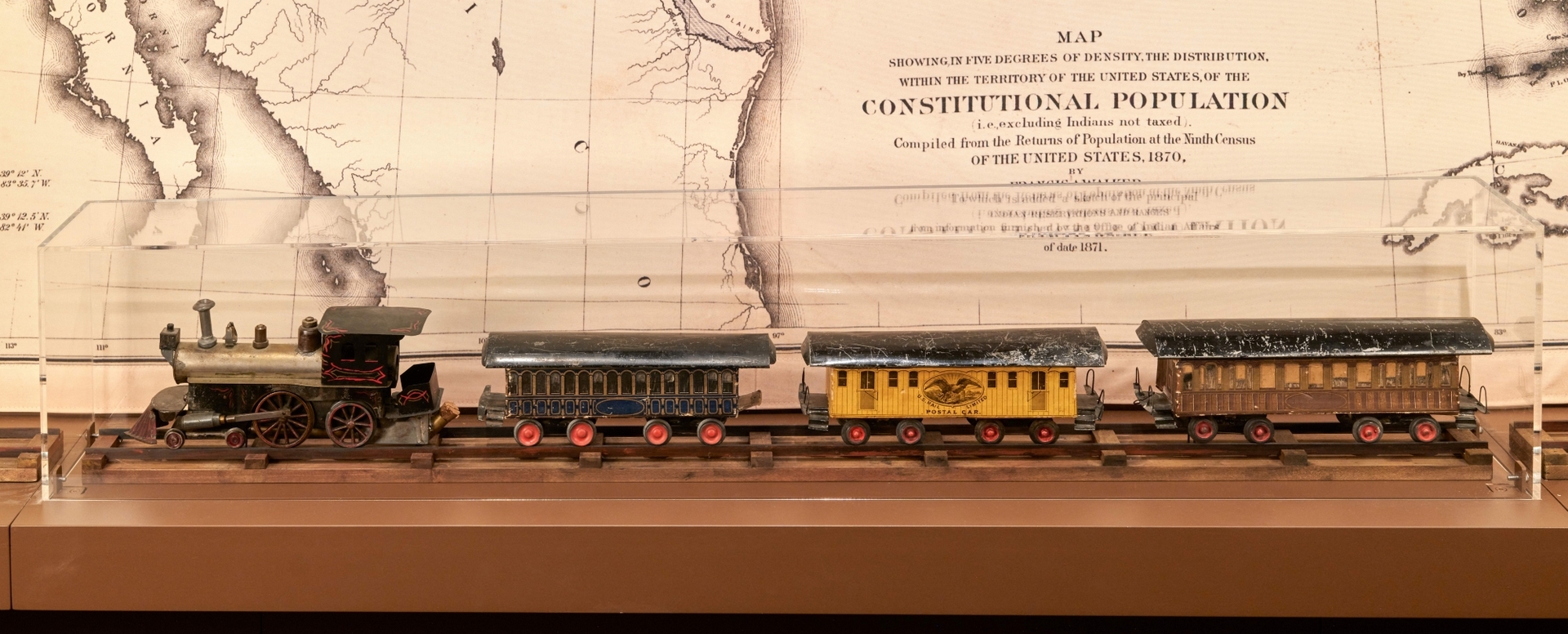
Railroad Workers
The transcontinental railroad,
completed in 1869, linked the eastern seaboard to the Pacific Ocean.
The
Central Pacific Railroad Company recruited roughly 15,000 Chinese laborers to
build the railroad’s western leg.
Crossing Mountains
To build the transcontinental
railroad across the Sierra Nevada Mountains, the largely Chinese workforce set
explosives, bore tunnels, and labored at precarious heights. Over 1,000 workers
died while performing these dangerous tasks.
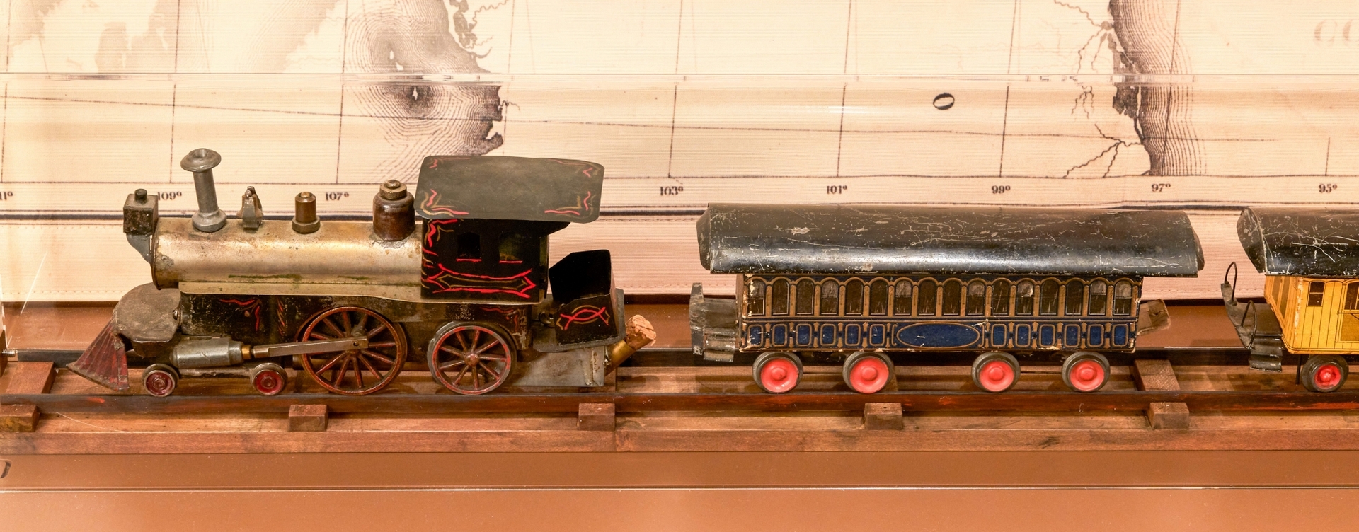
Beggs
Locomotive and train cars, late 19th century
New-York Historical Society, The Jerni Collection
Representing the US in Art
After the Civil War, Congress
funded multiple scientific surveys of western lands. Each survey generated
reams of data pertinent to the nation's economic development. But it was the
artistic products—created by photographers and artists who accompanied the
expeditions—that publicized the West for a national audience.
While surveying Colorado in
1873, photographer William Henry Jackson captured the first documentary image
of this 14,000-foot mountain in the Rockies. Its distinctive cross-shaped
snowfield had been spoken of as a Christian symbol since the time of Spanish
exploration, but few had seen it. Jackson's photograph made the Mountain of the
Holy Cross a familiar icon.
Jackson’s photograph also inspired
the western landscape painter Thomas Moran to travel to Colorado to create his
own version of this natural wonder. Moran's monumental painting went on display
in Washington, DC, in 1875, where it would have reinforced the prevailing idea
of a divinely sanctioned westward expansion.

Thomas Moran
Mountain of the Holy Cross, 1876
Facsimile
Patricia D. Klingenstein Library, New-York Historical Society
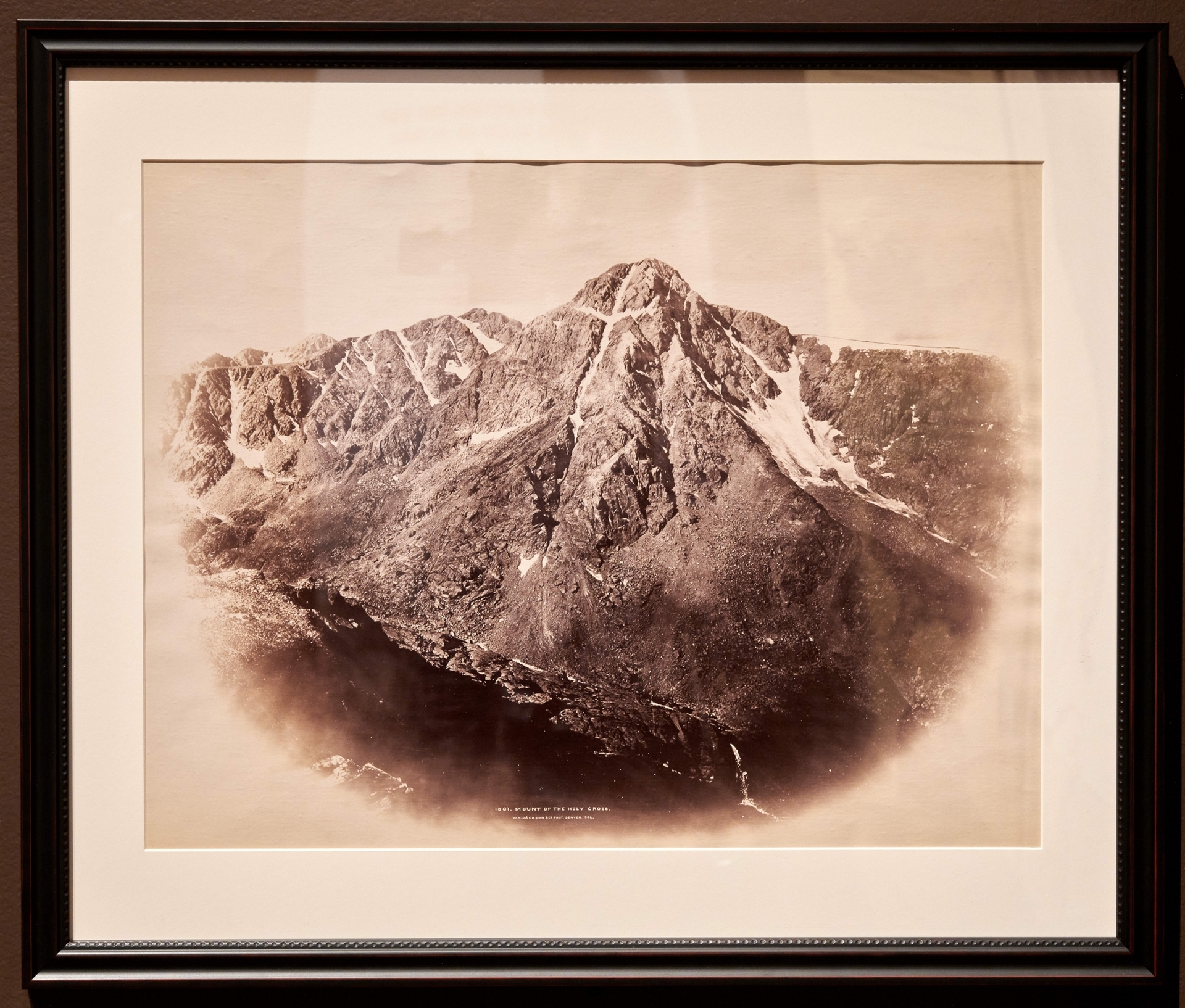
William Henry Jackson
Mountain of the Holy Cross
Patricia D. Klingenstein Library, New-York Historical Society